
Walking a Germantown Street Record Trail
For a current Germantown address, begin with the Shelby County Assessor real-property search. Its address mode accepts a street number and street name. The assessor asks users to leave out a street direction and suffix, so an entry such as MAIN is preferable to a fully expanded street label. Save the parcel number, owner spelling, situs address, and legal-description details before moving on. A situs address is the physical property location. It is not necessarily where the owner receives mail or where every person connected with the parcel lives.
That first parcel result is a stable handoff point. Use it to compare the county map and deed index, then use a registration lookup only when the exact name and ZIP are already known. Older household clues belong in the historical collections, not in a present-day ownership result. The sequence below keeps the inquiry focused on address-keyed records instead of turning one partial result into a household roster.
- Enter the street number and name in the assessor’s address mode, omitting direction and suffix as the office instructs.
- Record the parcel ID and situs address, then locate the same parcel in ReGIS or the Germantown map dashboard.
- Use the parcel ID, lot, subdivision, or legal description in the Register of Deeds index to find recorded transfers.
- When an exact voter name and ZIP are known, use GoVoteTN only as individual registration confirmation.
- For an older address trail, compare dated directories and archive material with the parcel’s legal description.
Note: Keep the source date beside every address result, because a deed, tax mailing line, and map layer can describe different moments.
Germantown Street Directory Assessor Fields
The Shelby Assessor is the main current property starting point for an address search. It offers separate address, owner-name, business-name, and parcel-number routes. The separate modes matter. Address mode answers which parcel is associated with a situs. Owner mode answers who is listed as owner. A business or trust can appear in the owner fields, so the result should not be treated as a resident confirmation. When an address has a unit, compare the unit information in ReGIS before assuming a single parcel represents one household.
| Assessor field | Entry type | When used | Germantown search note |
|---|---|---|---|
| Street Number | Text | Address mode | Enter the number for the situs search. |
| Street Name | Text | Address mode | Do not enter direction or suffix. |
| First and Last Name | Text | Owner mode | Use only after an owner name is already known. |
| Business Name | Text | Business-owner mode | Useful when the parcel is held by an entity. |
| Parcel Number | Text | Parcel mode | Best bridge between the property, map, and deed search. |
See the live Shelby Assessor property-search screen before entering a new query.
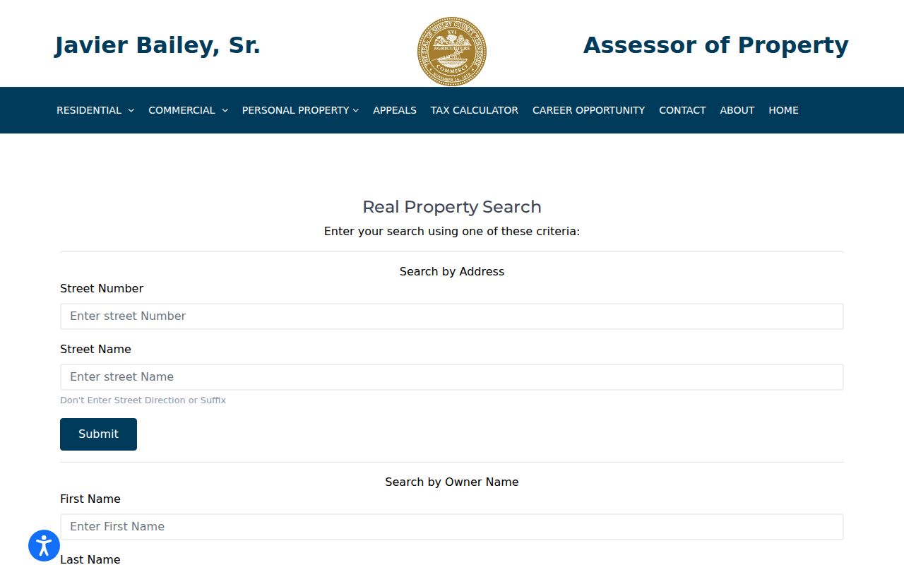
The screen shows why number-and-name searches should be kept separate from owner and parcel searches in an address-record workflow.
The statewide Tennessee Property Assessment Data search adds owner name, property address, subdivision, classification, sale-date, and control-map components. Its published field list does not expose a ZIP filter for Shelby searches. Use it to refine an address, subdivision, or parcel lead, not to promise a ZIP-wide property list.
The Tennessee Property Assessment Data advanced screen is a useful reference when a subdivision or control-map detail appears in a Germantown parcel result.
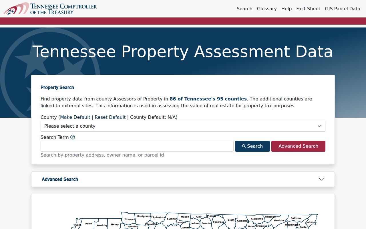
Those additional fields can help distinguish similar street names while leaving address and ZIP claims tied to the source that actually supplies them.
Mapping Germantown Streets by Parcel
Use the Germantown interactive GIS dashboard to place an address in its city-layer context, then compare it with the county’s parcel data. The dashboard is the more approachable map layer. The county ReGIS service supplies the explicit parcel geometry and owner/address schema. Pan to the street, identify a target parcel, capture the parcel ID and property location, and inspect adjacent polygons one at a time. Parcel edges are map data, not a legal survey.
The Germantown GIS dashboard illustrates the mapped context around a street address.
Use its layers to orient the address, then verify ownership and legal boundaries with the county parcel and recorded-document sources.
The county’s ReGIS parcel layer supports identify and query functions, pagination, ordering, and query-with-distance. Its related owner table separates the property location from mailing lines. That distinction is important when a tax notice goes to a trust, company, estate, or address outside Germantown. It is a locate clue, not proof of current occupancy.
The public ReGIS parcel service displays the geometry and field framework used for a street-by-street comparison.
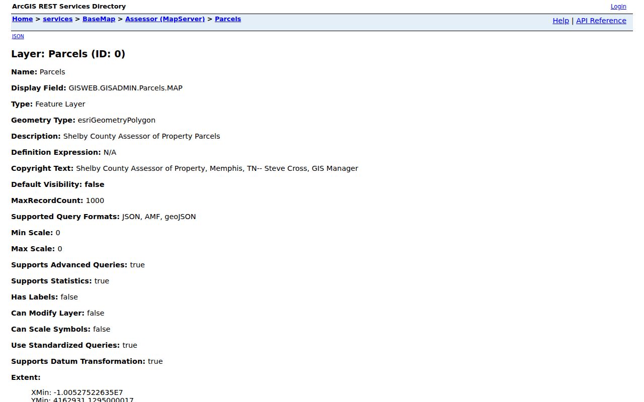
Its parcel ID and location fields make it easier to carry one carefully identified property into the assessor and deed systems.
Germantown Street Record Labels
A few labels prevent confusion when several records share one street. ReGIS separates the property’s situs components from the owner’s mailing lines, including ZIP and ZIP+4. The Register index can use an address, parcel, lot, subdivision, grantor, or grantee. A plat connects a lot and block to a subdivision layout. These are different keys, and each can rescue an address search when an older document lacks the modern street label.
- Parcel
- A county identifier for a land unit, used to connect assessor and map records.
- Situs address
- The physical location assigned to the parcel, rather than the owner’s tax-mailing address.
- Plat
- A recorded subdivision map that can show lots, blocks, roads, and easements.
- Criss-cross directory
- A reverse directory arranged by address, used as a dated historical snapshot.
For historical households, the Germantown city directories collection is the appropriate shelf for dated reverse-directory and regional-directory work.
Following Germantown Deeds Along a Street
The Shelby County Register of Deeds property index adds the recorded-transfer layer to a Germantown address search. Start with the assessor owner as a possible grantee, then search the address, parcel, lot, or legal description. The Register also advises leaving direction and street type out of an address search. If an older instrument lacks an address, continue with the lot, subdivision, parcel, book/page, or party names found in the newer deed.
A grantor transfers an interest. A grantee receives it. For a backward chain, search the current owner’s acquisition, then search the seller as an earlier grantee. Carry the legal description with the chain because a surname search may mix unrelated parcels. A warranty deed often records a sale transfer; a quitclaim can signal a family or estate transfer. A mortgage is security for a loan, not by itself a transfer of ownership.
Open the Register’s name, parcel, address, and instrument search to see the available tabs.
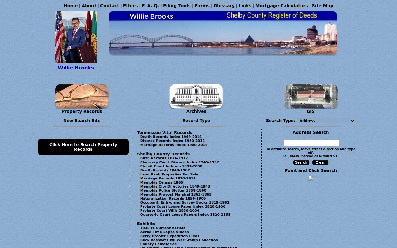
The index screen supports a focused document trail, but older documents may need a parcel or legal-description bridge rather than a modern address.
Germantown Address Permits and Code Dates
Address-based city material can supply dates that do not appear in a deed chain. The Germantown engineering permit route handles demolition, grading, foundation, and right-of-way work, with online submission, review, and electronic issuance. Permit applications can include a property address, lot, subdivision, parcel, applicant, company, and project details. Those names identify a project role, not necessarily an owner or resident.
A city zoning or property-letter request can ask for the property address or location, zoning, open violations, site-specific permits or plans, adjacent-property zoning, variances, and pending land-use applications. The published form lists a $35 basic or $60 detailed request and says no email application. For a missing municipal record, route a narrow request through the Germantown open-records process. Tennessee citizens may inspect non-exempt records under the Tennessee Public Records Act, and a custodian that cannot promptly produce a record must respond within seven business days.
Note: Ask for an address, permit type, date range, or project number rather than requesting a newly compiled list of people.
Germantown Street Names Across Eras
Street research in Germantown crosses more than one place label. The community began as Pea Ridge in 1833, was renamed Germantown in 1836, and temporarily used Neshoba during World War I. Charter boundaries also refer to 1903, 1921, the March 8, 1955 referendum, and later annexation ordinances. A historic tract may therefore appear as rural Shelby County, Pea Ridge, Neshoba, a subdivision, or a later Germantown address.
Use the legal description and a recorded plat to bridge those labels. Germantown Road, Poplar Pike, the railroad, and the depot can appear in older local references where a modern subdivision street does not. No official year-by-year street-renumbering schedule was located, so a date should not be invented. The Register’s occupant, entry, and survey books cover selected material from 1819 to 1962, but they are not a complete modern chain.
Germantown Street Directory Record Coverage
Address research works best when each record set answers one narrow question. The coverage below separates mapped parcels, recorded documents, individual registration confirmation, and project records. It also shows why an address can produce useful facts without yielding a complete list of people at that location.
| Address-keyed record | Local custodian | What it can establish | Access route |
|---|---|---|---|
| Assessor parcel | Shelby Assessor | Owner, situs, mailing lines, value, and property characteristics | Public web search, phone, or counter. |
| ReGIS parcel layer | Shelby County ReGIS | Parcel shape, ID, owner fields, unit data, and address components | Public map and REST service. |
| Recorded deed or plat | Shelby Register of Deeds | Transfers, parties, lot/block, and legal descriptions | Public index; online images where available; email, mail, or counter copies. |
| Individual registration lookup | Shelby Election Commission | Election information tied to exact registration details | GoVoteTN name-and-ZIP or address-and-ZIP search. |
| Permit or zoning request | City of Germantown | Project, lot, subdivision, or address context | Engineering route or specific city request. |
Street-level work can begin with the visible address, but the parcel ID and legal description are more durable when an address has changed or a subdivision has expanded.
Confirming a Germantown Address Registration
GoVoteTN accepts either a voter’s first and last name with ZIP, or a street address with ZIP. The Shelby Election Commission supplies the data, and the help material asks users to enter registration details exactly as they appear on the voter card. A no-match can reflect a spelling difference, address change, inactive status, a protected record, or a data-refresh delay. It is not proof that a person does not live nearby.
View the official GoVoteTN search form before using its individual lookup modes.
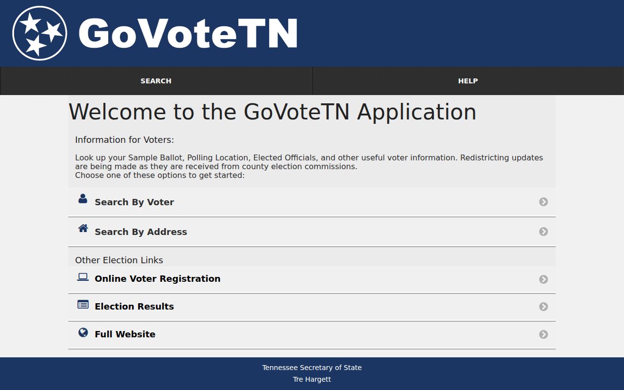
The name-and-ZIP and address-and-ZIP controls narrow a single registration check; they do not publish a street-wide household roll.
State law restricts a full Shelby voter-list request to Tennessee residents who certify a political purpose under T.C.A. § 2-2-138. The Election Commission’s public-records route also notes election-period limits and its usual five-business-day response. Those restrictions mean the paid list is not a general address-search substitute.
Limits of a Germantown Street Directory
A street search does not enumerate everyone who lives at a property. Assessor and deed records generally identify owners and recorded parties, not children, guests, or all household members. Utility customers, mail recipients, delivery records, and motor-vehicle addresses are not public household rolls. A mailing address in a property record can be in another city, state, or ZIP and must be labeled as a tax or GIS mailing line, with the date checked.
Tennessee Safe at Home gives qualifying participants a substitute address for many government interactions, but it does not replace a real address on property-tax assessment or recorded real-property documents. Ask the custodian about protective handling instead of trying to infer a protected location from unrelated records. For a street narrowed by postal area, use the Germantown ZIP Directory to separate ZIP geography from city boundaries.