
Tracing Germantown ZIP Coverage
Germantown has two confirmed postal patterns on city addresses, 38138 and 38139. Census geography also identifies 38120 and 38125 as ZCTAs that fully or partly intersect the Germantown city geography. The distinction matters. A Census intersection does not say that every address in a ZCTA uses Germantown as its postal city, and a Germantown postal label does not by itself establish municipal incorporation. Use the table as a starting map, then verify a particular deliverable address with USPS and the city line with GIS.
| ZIP / ZCTA | Germantown relationship | Postal designation | Local research note |
|---|---|---|---|
| 38138 | Core Germantown, including City Hall, the library, and many northern and central neighborhoods | Germantown postal designation | Confirm individual delivery with USPS. |
| 38139 | Southern and eastern Germantown context, including Forest Hill-Irene and Houston/GMSD areas | Germantown postal designation | Confirm the exact street boundary with USPS. |
| 38120 | Fully or partly intersects Germantown city geography in Census data | Not confirmed as a Germantown-wide postal label in the research | Postal and city lines are not interchangeable. |
| 38125 | Fully or partly intersects Germantown city geography in Census data | Not confirmed as a Germantown-wide postal label in the research | Check GIS before calling an address Germantown. |
The Shelby County ZIP map places 38138 and 38139 around Germantown and shows nearby 38119, 38120, and 38125. Its own warning says the map is not a legal boundary survey and its source lines may not align. That makes the map a useful orientation tool, not the final word for a single mailing address or property line.
Germantown ZIP Codes on City Addresses
Official Germantown pages consistently use 38138 and 38139 on city addresses. The 38138 pattern includes City Hall, the library, and many northern and central locations. The 38139 pattern appears with Forest Hill-Irene, Houston/GMSD, and southern or eastern locations. Those examples establish a city-address pattern, not a street-by-street Postal Service assignment. The research did not capture a live USPS result for either ZIP, so a specific delivery claim should wait for a fresh address lookup.
Corridor and subdivision names are helpful only as context. Germantown Road, Poplar Avenue and Poplar Pike, Farmington Boulevard, Neshoba Road, Wolf River Boulevard, Kirby Parkway, Forest Hill-Irene Road, Hacks Cross Road, and Winchester Road all cross a broader urban geography. Use a street number and the official postal lookup before attaching a ZIP to any one point on those corridors.
Note: A five-digit ZIP is designed for mail routing, while a parcel record and a municipal boundary answer different questions.
Germantown ZIP Boundary Myth
Myth: a Germantown ZIP proves that the property sits inside Germantown. The local research says otherwise. The Census Germantown place profile identifies 38120 and 38125 as intersecting ZCTAs alongside 38138 and 38139. A ZCTA is Census geography built from postal ZIP information. It is not a municipal boundary, and it cannot tell a reader which city label USPS assigns to a particular street address.
Postal and municipal mismatches are expected near the Memphis urban edge. An address within an intersecting 38120 or 38125 ZCTA is not automatically a Germantown property. The reverse is also true: a Germantown mailing label alone does not prove incorporation. Compare the USPS result with the Shelby ReGIS viewer and the Germantown GIS dashboard when city geography matters.
Verifying a Germantown ZIP Code
For a questioned address, start with the official USPS postal lookup to verify the deliverable mailing ZIP. Next, use city or county GIS to establish the municipal context and parcel. Then consult the assessor or ReGIS owner table for the situs address and any separately labeled tax mailing lines. If a legal description is needed, move to the Register’s deed or plat index. That order keeps postal delivery, city location, parcel identity, and recorded land information from being blended into one claim.
- Enter the full street address in the USPS postal lookup and retain the date of the result.
- Locate the address in Germantown GIS or Shelby ReGIS to check the parcel and city geography.
- Use the assessor address search or parcel number to confirm the situs record and parcel ID.
- Search the Register by address, parcel, lot, subdivision, or legal description if a deed or plat is needed.
- Use an election lookup only when an exact voter name or exact address and ZIP are already known.
The research did not locate an official static street-level USPS boundary file, a ZIP split or realignment notice, or a post-office-station inventory. Preserve that gap instead of assigning a ZIP to an entire subdivision from a broad map.
Germantown Postal Fields in ReGIS
The county’s ReGIS owner and address table exposes ZIP and ZIP+4 in the owner’s mailing-address lines. It also separates parcel ID, owner names, address number, direction, street, suffix, city, state, building or unit data, and notes. The visible ZIP fields belong to the mailing-address side of the record. They should be labeled as such, with a date checked, rather than being described as the parcel’s present occupancy ZIP.
The ReGIS parcel service is the county source behind that field structure.
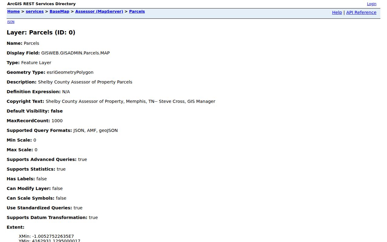
The map and related owner table help compare a property location with a separately stored mailing line, but neither creates a ZIP-wide list of residents.
ReGIS supports map identify and query actions, while the assessor’s current public page uses address, owner name, business name, and parcel number modes. Neither published current interface shows ZIP as a property-search field. Search the known address or parcel, then read the ZIP data that actually appears in the result.
Germantown Property Search Fields
Tennessee Property Assessment Data offers an advanced screen with county, quick search term, owner name, property address, subdivision name, classification, sale-date range, control map, group, parcel, and sorting choices. It can refine a Shelby property search after a ZIP has been verified elsewhere. Its published advanced field list does not expose a ZIP field, so it should not be used as evidence of a complete ZIP-wide property search.
| TPAD field | Type | Use for a Germantown result | ZIP-code limitation |
|---|---|---|---|
| County | Dropdown | Select Shelby County. | Not a ZIP filter. |
| Search Term | Text | Property address, owner name, or parcel ID. | ZIP is not listed as an accepted term. |
| Property Address | Text | Street number may be optional. | Refines an address, not all addresses in a ZIP. |
| Subdivision Name | Text | Useful when a plat or assessor record supplies it. | Subdivision and postal area can differ. |
| Control Map / Group / Parcel | Text | Matches structured parcel components. | Use after a parcel is identified. |
The advanced property-search interface shows its published field choices.
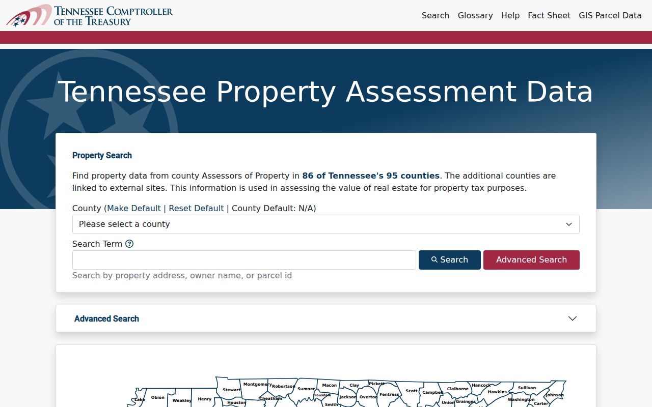
It supports address and parcel refinement, while a verified USPS result remains the proper source for deliverable ZIP information.
Germantown ZIP Voter Fields
GoVoteTN is ZIP-capable in two individual lookup routes. A voter search uses first name, last name, and ZIP. An address search uses street address and ZIP. The service is supplied by local county election commissions and asks for the registration information exactly as it appears on the voter card. It is a narrow confirmation tool, not a public list of every person in a ZIP area.
| GoVoteTN field | Input | Search route | Format note |
|---|---|---|---|
| First Name | Text | Voter-name mode | Pair with the registration last name and ZIP. |
| Last Name | Text | Voter-name mode | Enter exactly as on the registration card. |
| ZIP Code | Text | Name or address mode | Narrows an individual lookup. |
| Street Address | Text | Address mode | Pair with ZIP. |
| County | Selector | Help and county route | Shelby contact details are supplied through the service. |
A full Shelby voter list has a different legal route. It is restricted to Tennessee residents who certify a political purpose under T.C.A. § 2-2-138. The paid request is not a substitute for an address-based directory.
Finding Records Within a Germantown ZIP
A ZIP can narrow a known-address workflow, but it cannot reliably produce a full set of people in an area. Use the verified delivery ZIP with the exact address, then select the record system that answers the next question. The assessor does not publish ZIP among its current search modes. ReGIS stores mailing ZIP fields after a parcel is found. GoVoteTN accepts ZIP only with an individual name or address search. The Register has City and Zip fields, but warns that those fields are absent from some recorded documents.
- Confirm the full address and ZIP with USPS.
- Find the property by street address or parcel in the assessor or ReGIS system.
- Read ReGIS ZIP and ZIP+4 only as mailing-line fields when they are present.
- Use the Register’s address, parcel, lot, or legal-description keys, even if City or Zip returns nothing.
- Use GoVoteTN only for a precise individual registration check with the required ZIP pairing.
Once the ZIP has narrowed an area to a particular road, the Germantown street directory has the address-to-parcel and deed-chain workflow.
Note: A ZIP filter may omit older deed documents, so an empty City or Zip result should be retried through parcel, lot, party, or legal-description fields.
Germantown ZIP Codes and Legal Descriptions
A recorded deed or plat ties land through a legal description, lot, block, subdivision, or parcel ID. Those keys survive changes in postal labels, annexation context, and street wording more reliably than a ZIP. In Germantown, historic material may refer to Pea Ridge, Germantown, temporary Neshoba, rural Shelby County, or a later subdivision. Charter boundaries reference 1903, 1921, the March 8, 1955 referendum, and later annexation ordinances, so a historic place label needs a dated legal-description bridge.
The Register’s archive lists occupant, entry, and survey books from 1819 to 1962. Current map and deed tools are separate layers, not proof of one complete electronic timeline. A parcel near a modern ZIP boundary may need its subdivision plat and recorded description checked before an older record is assigned to the present city or postal category.
Limits of a Germantown ZIP Code Directory
No local public source found in the research supplies a complete resident list for a five-digit ZIP. A property result can identify an owner, a parcel location, and perhaps a tax mailing line. A deed can document recorded parties and land details. An individual election lookup can return election information linked to exact registration data. None of those sources proves every occupant, and restricted utility, delivery, motor-vehicle, and protected-address records should not be treated as a back door around that limit.
- ZIP and ZIP+4
- A five-digit mailing area and an added delivery-specific segment. ReGIS displays ZIP and ZIP+4 as mailing-line fields.
- PO-box ZIP
- A postal code used for post-office boxes. No Germantown PO-box-only ZIP was identified in this research pass.
- Unique ZIP
- A ZIP assigned to one organization or high-volume recipient. No Germantown unique ZIP was identified in this research pass.
- Carrier route
- A postal delivery sequence used for routing. It is not a municipal-boundary or household roster.
Use Tennessee Public Records Act requests for specific existing local records when an online result is unavailable. Tennessee citizens may inspect non-exempt records, and the custodian must produce, deny in writing, or explain the reasonable production time within seven business days when prompt production is impracticable.